

RESOURCES
Use these free resources to understand how geospatial data can be used across different topics and scenarios.
All of these resources are suitable to be used in all classrooms, regardless of subject.

Websites and Webapps

Geography

Felt
Interative webmaps and dashboards on a variety of topics

ArcGIS StoryMaps
Interactive story maps on a variety of topics

The True Size
Interactive webmap exploring projection and country size
Mapping

Ordnance Survey
Mapping and GIS resources for students of all ages

ArcGIS Map Design Principles
Interactive story map showing map design principles

Carto Map Design
Interactive webmaps showing map design principles

Map Chart
Beginner-friendly mapping resource for world-wide maps

Data Wrapper
Beginner to intermediate resource for creating a variety of map types
Coding

Rodocodo
Learn to code by moving your cat to pick up coins around the board

Code Monkey
Learn to write code. Catch bananas. Save the world!

Code Wizards HQ
40+ free coding resources for kids of all ages
Maths and Science

Learner.org Interactive Geometry
Interactive webapp for geometric shapes and concepts

Geogebra
Explore a variety of maths concepts through interactive modules

PhET
Free interactive science and maths simulations

Biodigital
Human anatomy visualised in interactive 3D
Activities


Want to know more about hydrographic surveying? Book our Sea, Sounds and Surveying workshop
20 - 30 mins

Learn more about Geospatial
Geospatial Podcasts
We have created a playlist with all our favourite geospatial podcasts so you can listen on the go!
Browse below or follow on Spotify.
Free Posters

What is Geospatial Engineering?
Geospatial Engineering includes surveying, mapping and GIS. It allows us to measure, map and monitor the earth.

Airborne LiDAR
LiDAR (Light Detection and Ranging) is a type of laser scanning which is used to rapidly scan the terrain usually from an aircraft. It is also known as Airborne laser scanning (ALS).

GIS is Everywhere
Produced by Esri for GIS Day

Map Everything
Produced by Esri for GIS Day

We are GIS
Produced by Esri for GIS Day

Geospatial Engineering in Climate Change
Geospatial engineering techniques, such as Earth observation data and high-resolution satellite imagery are vital for monitoring, analysing and effectively planning to mitigate the effects of climate change

GNSS
GNSS stands for Global Navigation Satellite System and is the collective term for satellite-based navigation systems which allow users to determine the position of a receiver anywhere in the world.

Geography is Power
Produced by Esri for GIS Day

A New Hope
Produced by Esri for GIS Day

Mapping the Future, Today
Produced by Esri for GIS Day

Hydrographic Surveying
Hydrographic surveying is a specialised role which requires knowledge of the marine environment, global positioning systems and underwater acoustics.

Laser Scanning
Terrestrial laser scanning is a popular surveying method that can accurately
measure angles and distances to a point on a surface, such as the ground,
buildings and monuments.

Explore the Unseen
Produced by Esri for GIS Day
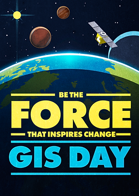
Be the Force
Produced by Esri for GIS Day

Understand Earth
Produced by Esri for GIS Day

Map the World
Produced by Esri for GIS Day

Discovering the World Through GIS
Produced by Esri for GIS Day

Celebrate the GIS Changemakers
Produced by Esri for GIS Day

Geoscience for the Future
Geoscientists will be crucial in meeting society's future challenges. Find out how!
Produced by The Geological Society.

Southampton - 1:5 000
This is the area directly around our Head Office in highly detailed 1:5 000 scale.
More colouring maps available if you sign up to the Ordnance Survey's monthly newsletter.

London - 1:10 000 scale
At 1: 10 000 scale, you'll need a steady hand to stay within the lines.
More colouring maps available if you sign up to the Ordnance Survey's monthly newsletter.

Milton Keynes - 1:10 000
It's an interesting visual mix for the Milton Keynes map.
More colouring maps available if you sign up to the Ordnance Survey's monthly newsletter.